Farming in Redbourn
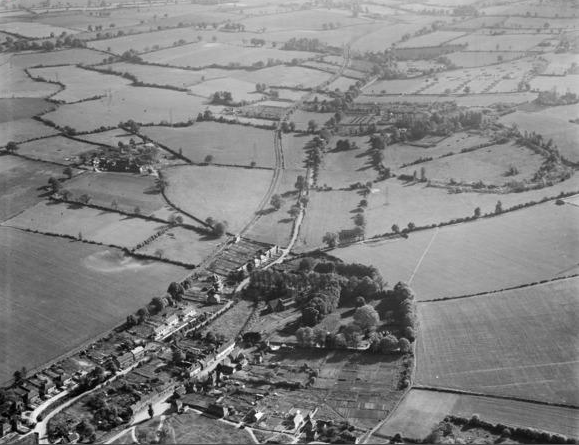
Note the railway and the absence of the M1 and the village by-pass
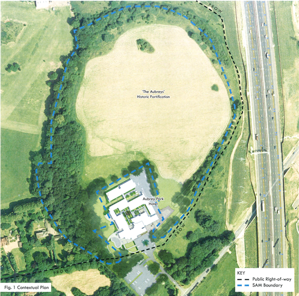
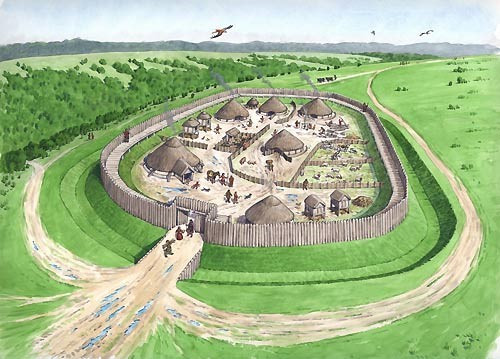
Commanding the River Ver, and near to the old Roman Road Watling Street, this Iron Age, oval in shape encampment, covers about 17½ acres. It was designed to be defensive, somewhere that local people and their animals could retreat to if threatened. As the reconstruction picture shows, the central area was enclosed by two banks and ditches on all sides apart from the north-west, where there is a single set of defences. There are traces of an outer counterscarp bank to the south-west. The Redbourn Research Group found evidence that the south east corner of the site may well have been underwater or at least regularly waterlogged as the River Red flowed close by. With reeds growing in this area, the name Reedy Stream or Red Bourn emerged. Entrances were simple, and placed at either end of the single set of defences, the main entrance facing west and a smaller gateway facing north-west. There have been flint finds at the site suggesting occupation as far back as 4000 BCE. Excavations indicate that in it was last used as a fortification, not a permanent settlement. Indeed the name Aubreys is Anglo Saxon meaning an old fortified place.
THE ENDS.
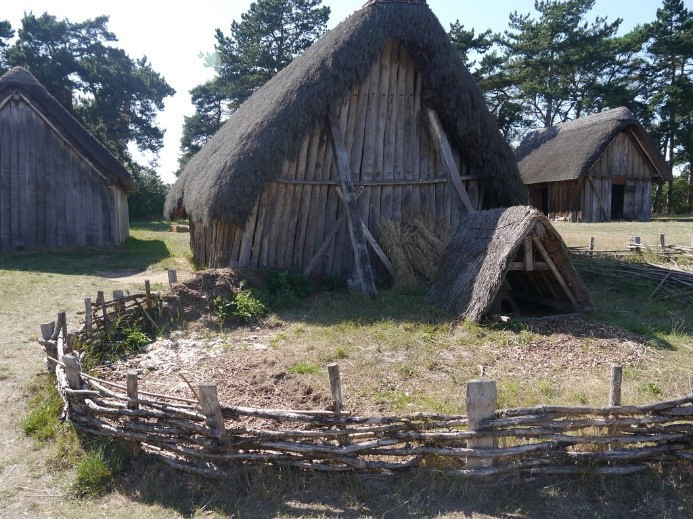
An End was a small clearing in the natural forest where you would find a few thatched huts, a central and larger hut for the headman and might be surrounded by a palisade.
The map below shows the “Ends” (shown in boxes)
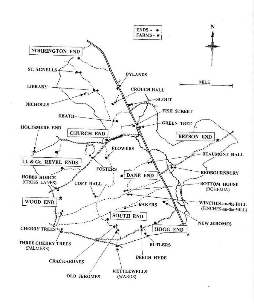
These ends came together to form the parish or manor as during the reign of Edward the Confessor, Aegelwine Niger (Le Swarte –black) gave Redbourn to the Abbey of St Albans. Each of these appear in documents until the middle of the 15th century. Some are connected to a particular family.
Norrington – Alice de Northington around 1296
Revel– Earlier references refer to Rutherfield End –Adam de Rutherfield from 1307
South– perhaps Adam Bisouthe around 1314.
Hogg– John Hogg in 1307 and Nicholas Hogg.
Beeson –Adam Bestney around 1344
Of the others, Church End takes its name from the old centre of worship and probably the oldest settlement. It has been suggested that the area Dane End could relate to the fact the Danelaw was only 5 miles to the north, or and more likely that the name derives from the fact that it is sited above a shallow valley (in Old English Denu).Wood End could have been a wooded area used by all.
campbell de burgh
| #
Hello
I am writing the story of my family which includes my grandmother, Mabel Patty Beaumont (1872 – 1961) who was the youngest daughter of Joseph Beaumont (1820 – 1890) of Flowers Farm. Joseph inherited Flowers Farm whilst his parents. John (1785 – 1850) and Elizabeth (1792 – 1855) Beaumont were in Fosters Farm next door. I would be most grateful if I could use material – images of the two farms and the map – from your very excellent Farm section to help illustrate the book.
Yours Aye
Campbell
Reply
campbell de burgh
| #
This is fascinating – especially the map. We are looking back into the ancestry of my family and specifically my grandmother Mabel Patty Beaumont who married my grandfather Hugo Henry Patrick de Burgh. Her parents were Joseph and Jane Beaumont of Flowers farm, Redbourn, and Joseph’s parents were John and Elizabeth Beaumont of Fosters Farm, Redbourn. We have come across the will of an Ann Beaumont of Flowers Farm which was proved after she died in 1834 but as far as we can see there is no mention of Joseph who would have been 12 at the time and living with his parents at Fosters. He is however recorded as living at Flowers in 1841. We think perhaps that Ann was a grandparent living at Flowers and that Joseph inherited Flowers when he came of age. The farms are next to each other near Church End. Fosters is now Aubrey’s hotel and Flowers is a training centre and there is a clear tie up with Google Maps and your excellent farm map.
Out of interest having looked at the way the Census of 1841 was constructed, and comparing it with the map, then Fosters Farm is the first on the list in a list of properties on one enumerators district going clockwise and Flowers Farm is first on the list of another enumerators district going anticlockwise from the point on the road between the two farms.
Both farms were in Beaumont ownership until we lost sight of Joseph’s parents after 1841 and then in 1890 Joseph died and Jane moved down to Footscray south of London. Without sons we presume that Flowers was sold in about 1890/91.
We are keen to pin down Ann Beaumont’s part in all this and also when Fosters Farm went out of the hands of John Beaumont. If you can help in any way either directly or by putting me on to a local historian with this kind of interest we would be most grateful. We live in Dorset but have a son in London so could visit at some point if that would be useful.
Thank you
Campbell de Burgh, 29 Briantspuddle, Dorchester, Dorset DT2 7HT tel 01929 471171
Reply